Q: How can I interpolate only some gaps from my DTM in NaviModel Producer?
A: In NaviModel Producer 4.11 a new feature called Fill area tool has been introduced. This is available by right clicking on the DTM and select Fill area tool (Figure 1). This tool comes in support to the processing surveyors who are looking for a quick infill on the DTM and not for a full gaps interpolation on the whole DTM (the other interpolation method is to be found under the Surfaces menu - Add interpolated).
The interpolation method used is the same (a method similar to inverse distance to weight where the interpolation is done using the data(raster) from the dTM and not directly the points).

Figure 1 - Fill area tool
Once the tool is enabled a new window will appear in the Map View and the user can draw the area where the gap must be interpolated (Figure 2). Once the polygon is drawn the tool will start to interpolate the gap and show the results in the Map View, by updating the DTM, and in the .xyz file under the DTM Source files in the Project tree (Figure 3).
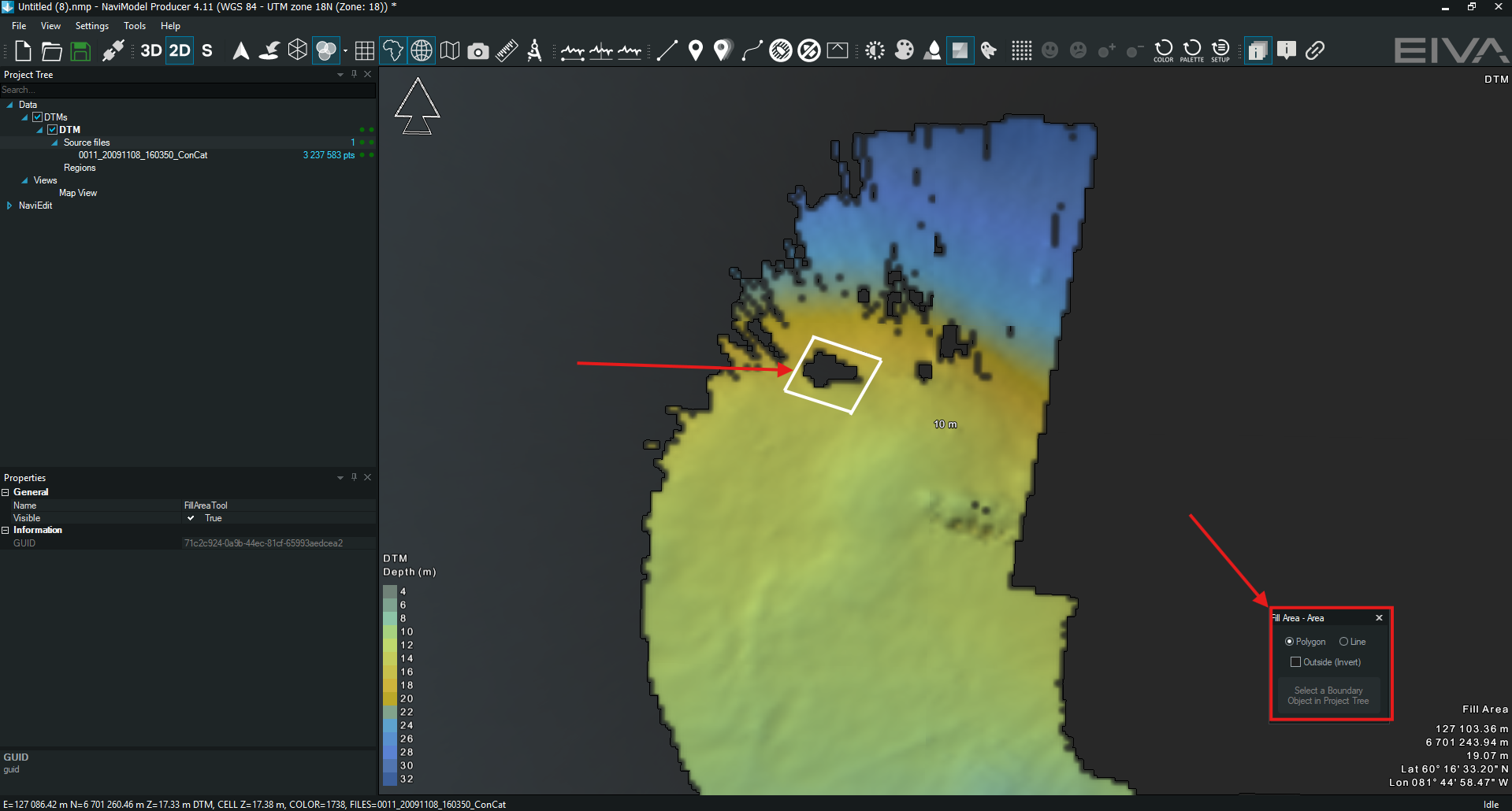
Figure 2 - Activating the tool and drawing a polygon

Figure 3 - Gap interpolated and the results
The .xyz file used for the gap interpolation is stored within the project and allows the restoration if needed. The file can be found in C:\Users\...\AppData\Local\Temp\NaviModel Producer\Fill_rcbjch.xyz.
This tool adds the interpolation to the DTM and when exporting the DTM the infills will be included as well. Using the other methods of interpolation will require the selection of the interpolated surface to be selected first (Figure 4).

Figure 4 - Interpolated surface selection for exporting.